! Doprava ZADARMO už od 20 € !

Jazyk


Veková kategória


Hodnotenie


Dostupnosť


Väzba


Stav


Rezervácia na predajni


Edície


Knihy - Atlasy sveta, rodinné atlasy strana 3 z 4

Lacná kniha Veľký atlas sveta 2. vydanie (-70%)


Veľký atlas sveta – atlas pre celú rodinu Kontinenty a oceány, pohoria a nížiny, jazerá, rieky a mestá – tento atlas vám umožní objavovať celý svet z pohodlia domova. Ponúka ľahkú orientáciu, dobre čitateľné mapy štátov a prehľad najdôležitejších informácií o jednotlivých krajinách. Veľký atlas sveta poslúži každému čitateľovi – ako pomoc pri školských úlohách, pri plánovaní ciest alebo len tak zo zvedavosti.
Vypredané
8,97 € 29,90 €

dostupné aj ako:

Lacná kniha Veľký atlas sveta 2. vydanie (-50%)


Veľký atlas sveta – atlas pre celú rodinu Kontinenty a oceány, pohoria a nížiny, jazerá, rieky a mestá – tento atlas vám umožní objavovať celý svet z pohodlia domova. Ponúka ľahkú orientáciu, dobre čitateľné mapy štátov a prehľad najdôležitejších informácií o jednotlivých krajinách. Veľký atlas sveta poslúži každému čitateľovi – ako pomoc pri školských úlohách, pri plánovaní ciest alebo len tak zo zvedavosti.
Vypredané
14,95 € 29,90 €

dostupné aj ako:

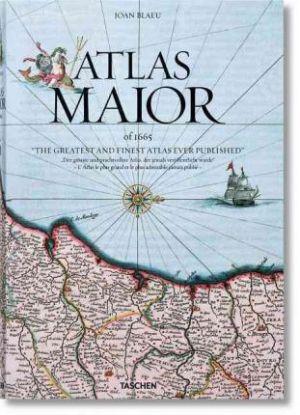
Blaeu - Atlas Maior


World class: The finest atlas ever publishedSuperlatives tend to fail in face of Joan Blaeu s Atlas Maior, one of the most extravagant feats in the history of mapmaking. The original Latin edition, completed in 1665, was the largest and most expensive book to be published during the 17th century. Its 594 maps across 11 volumes spanned Arctica, Asia, Europe, and America. Its scale and ambition occupies such an important place in Dutch history that it is included in the Canon of Dutch History, an official survey of 50 individuals, creations, or events that chart the historical development of the Netherlands.TASCHEN s meticulous reprint brings this luxurious Baroque wonder into the hands of modern readers. In an age of digitized cartography and global connectivity, it celebrates the steadfast beauty of quality print and restores the wonder of an exploratory age, in which Blaeu s native Amsterdam was a center of international trade and discovery.True to TASCHEN s optimum reproduction standards, the edition derives from the Austrian National Library s complete colored and gold-heightened copy of Atlas Maior, assuring the finest detail and quality. University of Amsterdam s Peter van der Krogt introduces the historical and cultural significance of the atlas while providing detailed descriptions for individual maps, revealing the full scale and ambition of Blaeu s masterwork. As much an artwork as a cartographical adventure, the book comes with a slipcase that converts neatly into a display bookstand.Text in English, French, and German"
Vypredané
62,65 € 65,95 €

Complete Atlas of the World


Complete Atlas of the World is the ultimate insight into our planet and the clearest, most concise overview of the world's geography. This incredible guide showcases locations from Boston to Bangkok and beyond with over 330 maps, including over 100 city plans, to truly bring these landscapes to life. Complete Atlas of the World is the definitive look at the world we live in. Detailed terrain models and colour schemes offer accessible mapping of unsurpassed quality. Complete Atlas of the World is now fully revised and updated to reflect recent geopolitical changes such as the new nation of South Sudan and the annexation of Crimea. Understand the fascinating world in which we live with this fantastic resource. Its previous edition ISBN 9781405394413.
Vypredané
42,75 € 45,00 €

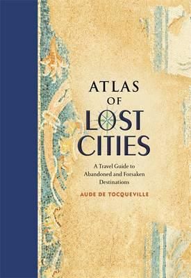
Atlas of Lost Cities


Like humans, cities are mortal. They are born, they thrive, and they eventually die. In Atlas of Lost Cities, Aude de Tocqueville tells the compelling narrative of the rise and fall of such notable places as Pompeii, Teotihuacan, and Angkor. She also details the less well known, including Centralia, an abandoned Pennsylvania town consumed by unquenchable underground fire; Nova Citas de Kilamba in Angola, where housing, schools, and stores were built for 500,000 people that never came; and Epecuen, a tourist town in Argentina now swallowed up by water. Original artwork shows the location of the lost cities, as well as a depiction of how they looked when they thrived.
Vypredané
20,85 € 21,95 €

Môj atlas sveta


Dievčatá a chlapci, vydajte sa do veta a podniknite objavné cesta. Vďaka detailným ilustráciám a zrozumiteľným textom sa niečo nové naučíte, ale aj sa zabavíte. Náučná knižka je plná hádaniek, záhad a okienok. Keď ich otvoríte, zasa sa niečo nové dozviete. – Viac ako 60 okienok – Deti môžu objavovať samy alebo čítať s rodičmi – Pre dievčatá a chlapcov od 4 rokov – Hry a hádanky
Vypredané
9,41 € 9,90 €

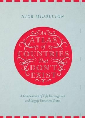
An Atlas of Countries that Dont Exist


Acclaimed travel writer and Oxford geography don Nick Middleton takes us on a magical tour of countries that, lacking diplomatic recognition or UN membership, inhabit a world of shifting borders, visionary leaders and forgotten peoples. Most of us think we know what a country is, but in truth the concept is rather slippery. From Catalonia to the Crimea, and from Africa's last colony to the European republic that enjoyed just a solitary day of independence, the places in this book may lie on the margins of legitimacy, but all can be visited in the real world. Beautifully illustrated by fifty regional maps, each shadowy country is literally cut out of the page of this book. Alongside stories, facts and figures, this Atlas brings to life a dreamlike world of nations that exist only in the minds of the people who live there.
Vypredané
24,65 € 25,95 €

Lacná kniha Pod plachtami domů - Na plachetnici na cestě kolem světa 3 - Fidži, Vanuatu, Nová Kaledonie, Austrálie, Indonésie, Singapur, Malajsie, Thajsko, Rodrigues, Mauricius, Réunion, Jižní Afrika, Svatá Helena, Karibik (-90%)


Po třech letech putování po mořích a oceánech jsme se ocitli na opačné straně zeměkoule. Tam začíná naše cesta zpět, cesta domů. Pouze my dva a plachetnice IRMA a před námi téměř 20 000 Nm. Plavba z Nového Zélandu do Austrálie vedla přes exotické pacifické ostrovy Fidži, Vanuatu a Novou Kaledonii.Později jsme prožili několik měsíců v Sydney, Melbourne a také v obytném autě při 4000 km dlouhé cestě podél východního a jihovýchodního pobřeží Austrálie. Dlouhá a náročná plavba Velkým bariérovým útesem a Torresovým průlivem nastavila zrcadlo našim dovednostem a psychické odolnosti. Potkala nás těžká chvíle, když se loď po uvolnění kotvy nekontrolovaně hnala na útesy. V Indonésii jsme se měsíce proplétali mezi zapomenutými a chudými ostrovy. Ale nevynechali jsme také věhlasné destinace jako jsou Lombok, Bali a Borneo. Rušným Malackým průlivem pak dopluli do Malajsie a Thajska. Cestou jsme zažili i noční pokus o přepadení. Až na dno svých sil jsme si sáhli při plavbě Indickým oceánem, podél nebezpečného pobřeží na jihu Afriky a kolem Mysu Dobré Naděje. Z Kapského Města vedla naše cesta na ostrov Svatá Helena. Pak už nás čekal poslední a také nejdelší úsek, plavba do Karibiku. Po 29 dní a nocí jsme viděli kolem sebe jenom nekonečnou pustinu vod Atlantiku. Po téměř šesti letech jsme se ve zdraví opět vrátili do Karibiku, na Martinik. Prožili jsme mnoho krásných a neopakovatelných, ale také dramatických chvil se šťastným koncem. Byli v mnoha zemích , viděli úžasné přírodní scenérie, ale také místa poškozená činností člověka. Dotkli se a nahlédli do života lidí, který se velmi lišil od našich všedních i svátečních dnů.Viděli jsme jak bohatství tak i bídu světa. Všechno v nás zůstalo. Autoři:Ing.Jana Honsová (* 1951) a Ing. Otakar Hons,CSc. (*1947) vypluli v roce 2009 ze Švédska na cestu kolem světa na plachetnici IRMA. O svoje zážitky se podělili v knížkách „ Odhoď lana „ a „ Rok pod Jižním křížem „ vydaných nakladatelstvím Agentura KRIGL, Praha. Rovněž pravidelně publikují v časopisech a pořádají zajímavé besedy.
Vypredané
1,37 € 13,70 €

dostupné aj ako:

Atlas světa MD


Třetí aktualizované české vydání Atlas světa s podtitulem Svět v mapách, svět ve skutečnosti, svět v obrazech obsahuje vysoce kvalitní mapy a brilantní satelitní fotografie. Tento bohatě ilustrovaný lexikon světa neobchází ani aktuální globální témata. Na jeho konci najdete rozsáhlý rejstřík.
Vypredané
19,95 € 21,00 €

Directory of Flags: A guide to flags from around the world


For thousands of years, flags have been used to identify countries and cultures, people and places. Today, the flags of the world can still provide a key to discovering national identity and history of each and every country in the international community. Presented in a neat directory format, this book offers nearly 300 flags, each alongside the story of its provenance and design
Vypredané
11,88 € 12,50 €

Atlas 6th Edition


Carry the world in your pocket - now in its 6th edition. It might be small, but Atlas covers every region of the world, from the Atacama Desert to the Zagros Mountains. Now fully revised and updated, digital landscape modelling combined with important roads, railways, rivers and settlements give a complete global overview. Swot up for the pub quiz, with over 400 essential facts, figures and insights, from geography and climate to population and economy, for an intriguing journey through the fascinating world in which we live. Handy pocket size, Atlas is perfect for your bag or desk.
Vypredané
11,35 € 11,95 €

Lacná kniha Atlas 6th Edition (-90%)


Carry the world in your pocket - now in its 6th edition. It might be small, but Atlas covers every region of the world, from the Atacama Desert to the Zagros Mountains. Now fully revised and updated, digital landscape modelling combined with important roads, railways, rivers and settlements give a complete global overview. Swot up for the pub quiz, with over 400 essential facts, figures and insights, from geography and climate to population and economy, for an intriguing journey through the fascinating world in which we live. Handy pocket size, Atlas is perfect for your bag or desk.
Vypredané
1,20 € 11,95 €

dostupné aj ako:

National Geographic Atlas Of The World, 10th Edition


An invaluable source of information in a dynamic, interconnected world, the National Geographic's Atlas of the World, 10th Edition features authoritative, updated maps and beautifully illustrated contemporary themes in a large format designed to showcase the art and science of modern cartography. The newest edition of National Geographic's most prestigious and authoritative reference atlas once again delivers valuable information to help us understand our increasingly interconnected world. Contemporary global themes such as population trends, urbanisation, health and longevity, human migration, climate change, global communications, and the world economy are explained with illustrated maps and informational graphics. The core of any atlas is the reference mapping section and the 10th Edition has the largest and most comprehensive collection of political maps ever published by National Geographic. This completely updated mapping section has been expanded by 16 pages and features new maps for Ireland, Scotland, England and Wales, three detailed regional maps of Australia, expanded coverage of Africa, and a map of the strategically important area around the Mediterranean Sea encompassing North Africa and Southern Europe. In addition, there are special sections dedicated to the Oceans, Space, and Flags and Facts. These are followed by an expanded index, with over 150,000 place-names. Constructed of the highest-quality materials and presented in a large format that makes this atlas a centrepiece to gather around, the 10th Edition is the perfect reference tool for explaining how the present and past continually collide in today's fast-paced world.
Vypredané
151,05 € 159,00 €

Collins Primary World Atlas


A curriculum-supportive Primary World Atlas for children aged 7-11 years (Key Stage 2). Designed for use in the classroom or at home, this revised edition includes informative politically coloured reference mapping of all major world regions. * This primary world atlas provides an introduction to mapping of the UK, Europe and all major regions of the world. It includes information on map reading skills, the meaning of scale and measuring distances. * The reference maps are informative, politically coloured, and easy to read with national capitals and major cities easily identifiable. The maps are supported with national flags and basic national statistics. * Continental maps are linked to the regional mapping and are supported by a selection of satellite, aerial and terrestrial photographs. Continental relief maps show layer colouring and major physical features are highlighted. * The index uses a simple grid reference system and a selection of web addresses is included to help with further study. * The Collins Primary World Atlas is also available on CD for use on interactive whiteboards, and a full range of interactive flip charts to support this atlas are available as downloadable files. These charts are easy to use and allow teachers and learners to further develop atlas skills. Downloads are available from www.collinseducation.com/atlases * Try the free interactive online Primary World Atlas quiz.
Vypredané
11,02 € 11,60 €

Collins World Atlas


The new edition of this popular pocket-sized world atlas has fully up-to-date mapping and statistics, and includes the latest interesting facts about the world. This up-to-date world atlas reflects all recent global changes. Designed in the distinctive Collins style, this is a detailed guide to the world in a handy format. Detailed maps, specifically designed for this small format, provide balanced and up-to-date coverage of the world. The maps rely on the latest cartographic technology to ensure their accuracy, accessibility and distinctive style. The level of detail is impressive for such a small format atlas, and the index contains references to over 20,000 place names. INCLUDES: * All recent political changes included in the mapping. * Depicts place names changes around the world.
Vypredané
8,27 € 8,70 €

Concise World Atlas


From the defining boundaries of the Balkan states to the icy terrain of Antarctica, this title includes over 640 maps that created with the digital mapping techniques and satellite data are combined to bring you Earth in detail. It is an essential desktop reference for business, home or school use.
Vypredané
26,51 € 27,91 €

Compact Atlas of the World


This new edition of the Times Compact World Atlas, in a convenient, portable format, has been fully revised to bring all the maps and geographical information completely up-to-date to give an accurate picture of today's world. As with all the atlases in the Times range, it offers great authority, outstanding quality and attention to detail. Detailed reference maps in the distinctive and respected Times style provide balanced, systematic coverage of all parts of the world. Each continent is introduced by a political map showing individual countries, followed by regional maps showing towns and cities, roads, railways, international boundaries and topography. Key features of the atlas include: * The introductory section covers major world geographical themes - from earthquakes and volcanoes to population growth, communications and climate change - giving a global snapshot of our contemporary world. * Authoritative updated mapping of the whole world. * Geographical reference section with flags, statistics and facts for the world's states and territories. * Hundreds of place names updated. * Over 25,000 index entries. This is a complete world reference atlas in a convenient and easy-to use format, retaining the authority, style and detail of the larger atlases in the range.
Vypredané
16,53 € 17,40 €

Collins School World Atlas


An introductory atlas for secondary schools, perfectly designed to support and motivate Key Stage 3 students in geographical and mapping skills. * Previously published as the award winning Collins Foundation World Atlas the Collins School Atlas has been revised and extended. It features 96 pages of clear, easy to read maps, satellite images, an atlas skills section and hundreds of statistics. * This introductory atlas for secondary school students aged 11-14 is designed to help students develop map, atlas and data handling skills. The content adheres closely to the requirements of the National Curriculum and incorporates results of classroom testing. * Its clear and accessible layout will motivate pupils of all abilities at Key Stage 3 and S1-S2. An easy to follow introductory 'map and atlas skills' section, useful for both teacher and pupil, is followed by clear, easy to read reference maps presented with locator maps, fact boxes and flags, descriptive text, detailed map keys and photos. For this new edition more detailed reference mapping of the British Isles is included. * Carefully selected focus country studies include mapping on contrasting regions and special topics. * The latest available country-by-country statistics are listed in a separate section and the index includes full latitude and longitude values. * The extended world section in this edition covers all the global issues required by the National Curriculum e.g. climate, population, biomes, earthquakes and volcanoes. * Colour coding of the titling and marginalia aids the identification of the sections within the atlas.
Vypredané
12,35 € 13,00 €

Mini Atlas of the World


A pocket-sized Times Atlas of the World packed with the essentials. Fully revised and improved to take account of all recent changes from around the world. Complete map coverage of the world is provided with the accuracy and authority for which Times atlases are renowned. This new edition of The Times Mini Atlas of the World has been fully revised to bring all the maps and geographical information completely up to date. As with all the atlases in the Times range it offers great authority, outstanding quality and attention to detail. FULLY UPDATED The 117 pages of reference maps have been completely updated to provide accurate, accessible and attractive coverage of the whole world. The introductory section covers major world geographical themes - from climate and environment to population and urbanization - giving a global snapshot of our contemporary world. A comprehensive guide to the world's states and territories including flags, capital cities and key facts, make this the ideal reference atlas for home, school or office. MAIN FEATURES * 117 pages of authoritative up-to-date mapping of the whole world, including the newly independent country of South Sudan. * Geographical reference section with flags, statistics and facts for the world's states and territories. * Statistics and world maps on major geographical themes, including population, cities, climate and the environment. * Over 20,000 index entries.
Vypredané
9,60 € 10,10 €

Ak ste nadšeným cestovateľom a váš záujem siaha za hranice jednej knihy, táto kategória je určená pre vás. Nájdete tu široký výber atlasov, ktoré vás zavedú do rôznych častí sveta a poskytnú vám komplexný prehľad o geografii, kultúre, prírode a histórii rôznych regiónov.

Kategória Atlasy sveta, rodinné atlasy je plná detailných a prepracovaných atlasov, ktoré vám poskytujú informácie o rôznych geografických oblastiach. Nájdete tu atlasy, ktoré zahrňujú kontinenty, krajiny, regióny, mestá a ďalšie geografické jednotky. Sú to cenné nástroje pre štúdium, plánovanie ciest a objavovanie sveta.

Nájdete tu atlasy určené pre celú rodinu, ktoré obsahujú farebné ilustrácie, pútavé mapy, zaujímavé faktografické informácie, fotografie a popisy miestnych tradícií a kultúr.

Atlasy sveta vám umožnia objaviť rôzne regióny, zoznámiť sa s geografickými charakteristikami a národnými parkami, objaviť kultúrne a historické poklady a získať lepšiu predstavu o rozmanitosti sveta, v ktorom žijeme.

Rodinné atlasy sú vhodné pre všetkých členov rodiny, vrátane detí, a pomáhajú vytvárať puto s inými krajinami a kultúrami. Sú praktickým nástrojom pre vzdelávanie a zábavu a diskusiu o rôznych miestach a zemepisných údajoch.