! Doprava ZADARMO už od 20 € !

Jazyk


Veková kategória


Hodnotenie


Dostupnosť


Väzba


Stav


Rezervácia na predajni


Edície


Najpredávanejšie - Bestsellery - Knihy - Atlasy sveta, rodinné atlasy strana 2 z 4

Knižné bestsellery nesmú v našej ponuke rozhodne chýbať. Najpredávanejšie a najobľúbenejšie knihy slávnych spisovateľov vás vtiahnu do deja a ponúknu vám množstvo skvelých príbehov. Vyberte si žáner, ktorý je vám najbližší alebo darujte najnovšie knižné bestsellery ako darček svojim blízkym.

  • 5 /5

Svět - Univerzální atlas


Svět v mapách Aktuální fyzické mapy zachycují všechny kontinenty a země světa. Díky harmonicky zvoleným barvám map, promyšleným mapovým výřezům a dobře čitelnému písmu je Univerzální atlas moderním a přehledným souborem map. Země světa Mapovou část knihy doplňuje aktuální Lexikon zemí se všemi důležitými faktografickými údaji o jednotlivých státech. Univerzální atlas světa je díky němu praktickou a nepostradatelnou příručkou pro každého. Fascinující země Tato speciální doprovodná část atlasu pomocí barevných fotografií a informativních textů působivě ilustruje „přírodní“ superlativy naší planety – nejvyšší pohoří, nejnebezpečnější vulkány, nejmohutnější vodopády, nejteplejší poušte a mnoho dalších geografických rekordů. Obsáhlý rejstřík usnadňuje orientaci a vyhledání příslušných pojmů.
Vypredané
14,20 € 14,95 €

Concise World Atlas


From the defining boundaries of the Balkan states to the icy terrain of Antarctica, this title includes over 640 maps that created with the digital mapping techniques and satellite data are combined to bring you Earth in detail. It is an essential desktop reference for business, home or school use.
Vypredané
26,51 € 27,91 €

A Világ országai - Földrészenként, tájanként


A kézikönyv, amelynek terjedelme a korábbi kiadásokhoz képest tovább bővült, 193 önálló ország, 4 függetlenként működő állam (közöttük már Koszovó is), 2 megszállás alatt lévő terület, illetve 107 függő terület (külbirtok, autonóm országrész) részletes adatait, szöveges leírását, zászlóját, címerét és nemzetközi betűjelzéseit tartalmazza. A latin betűktől eltérő írást használó országok nevei a saját írásképükkel is szerepelnek. Az egyes országokat és függő területeiket földrészek szerint fejezetekbe s azokon belül régiókba sorolva mutatjuk be. A kötet végén névmutató segíti az államok és függő területeik megtalálását. A szemléletes földrész-, illetve régiótérképek mellett a kiadványt színes fényképek teszik látványosabbá. Korunk felgyorsult világgazdasági és geopolitikai folyamatai szükségessé teszik, hogy az el z kiadás után négy évvel – hagyományosan egy újabb olimpiai évben – az olvasóközönség naprakész információkhoz jusson Földünk országairól.
Vypredané
12,50 € 13,16 €

Brilliant Maps


Which nations have North Korean embassies? Which region has the highest number of death metal bands per capita? How many countries have bigger economies than California? Who drives on the 'wrong' side of the road? And where can you find lions in the wild? Revelatory, thought-provoking and fun, Brilliant Maps is a unique atlas of culture, history, politics and miscellanea, compiled by the editor of the iconic Brilliant Maps website. As visually arresting as Information is Beautiful and as full of surprising facts and figures as any encyclopaedia, Brilliant Maps is a stunning piece of cartography that maps our curious and varied planet. For graphic design enthusiasts, compulsive Wikipedia readers and those looking for the sort of gift they buy for someone else and wind up keeping for themselves, this book will change the way you see the world and your place in it.
Vypredané
18,95 € 19,95 €

Atlas vlajek


Proč má Kanada uprostřed vlajky javorový list? Co nese v zobáku orel na bílém pozadí mexické vlajky? Je pouhou náhodou, že všechny země Středního východu mají vlajky ve stejných barvách? Na tyto a mnohé další otázky odpoví tento bohatě ilustrovaný svazek plný historických a zeměpisných informací, ale také mnohých zajímavostí o detailech jednotlivých vlajek a národech, kterým patří. V barvách, symbolech a vzorech na vlajkách se skrývají legendy staré jako Země sama. Vydejte se na cestu (nejen) napříč kontinenty a zeměmi, do světa mýtů a historie, a poznejte svět, ve kterém žijeme.
Vypredané
20,85 € 21,95 €

Atlas of Lost Cities


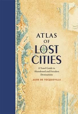
Like humans, cities are mortal. They are born, they thrive, and they eventually die. In Atlas of Lost Cities, Aude de Tocqueville tells the compelling narrative of the rise and fall of such notable places as Pompeii, Teotihuacan, and Angkor. She also details the less well known, including Centralia, an abandoned Pennsylvania town consumed by unquenchable underground fire; Nova Citas de Kilamba in Angola, where housing, schools, and stores were built for 500,000 people that never came; and Epecuen, a tourist town in Argentina now swallowed up by water. Original artwork shows the location of the lost cities, as well as a depiction of how they looked when they thrived.
Vypredané
20,85 € 21,95 €

An Atlas of Countries that Dont Exist


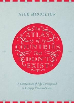
Acclaimed travel writer and Oxford geography don Nick Middleton takes us on a magical tour of countries that, lacking diplomatic recognition or UN membership, inhabit a world of shifting borders, visionary leaders and forgotten peoples. Most of us think we know what a country is, but in truth the concept is rather slippery. From Catalonia to the Crimea, and from Africa's last colony to the European republic that enjoyed just a solitary day of independence, the places in this book may lie on the margins of legitimacy, but all can be visited in the real world. Beautifully illustrated by fifty regional maps, each shadowy country is literally cut out of the page of this book. Alongside stories, facts and figures, this Atlas brings to life a dreamlike world of nations that exist only in the minds of the people who live there.
Vypredané
24,65 € 25,95 €

Atlas of Improbable Places


It is perhaps the eighth wonder of our world that despite modern mapping and satellite photography our planet continues to surprise us. Hidden lairs beneath layers of rock, forgotten cities rising out of deserted lands and even mankind's own feats of engineering eccentricity lie in the most unusual of destinations. Travis Elborough goes in search of the obscure and bizarre, the beautiful and estranged. Taking in the defiant relics of ancient cities such as Ani, a once thriving metropolis lost to conquered lands, and the church tower of San Juan Parangaricuto, that miraculously stands as the sole survivor of a town sunk by lava. Through the labyrinths of Berlin and Beijing - underground realms dug for refuge, espionage and even, as Canada's Moose Jaw, used as the playground for gangsters trading liquor and money over cards. Never forgetting the freaks and wonders of nature's own unusual masterpieces: the magical underground river shaped like a dragon's mouth in the Philippines and the floating world of Palmerston. With beautiful maps and stunning photography illustrating each destination, Atlas of Improbable Places is a fascinating voyage to the world's most incredible destinations. As the Island of Dolls and the hauntingly titled Door to Hell - an inextinguishable fire pit - attest, mystery is never far away. The truths and myths behind their creation are as varied as the destinations themselves. Standing as symbols of worship, testaments to kingships or even the strange and wonderful traditions of old and new, these curious places are not just extraordinary sights but reflections on man's own relationship with the world around us.
Vypredané
26,55 € 27,95 €

History of the World Map by Map


See history as it happened - from the evolution of early humans to the space race - with 130 detailed maps that bring pivotal episodes of world history to life. Including a foreword by renowned broadcaster and historian Peter Snow, this history atlas shows you the history of the world in thrilling action. Follow Napoleon as he conquers Europe, explore the rise of the Roman Empire, or chart the progress of the Russian Revolution as each map presents an overview of the story then takes you, step by step, through how it developed, leaving its mark on land and ocean. With cutting-edge design and breathtaking scope, History of the World Map by Map charts ancient, medieval, and modern history in all corners of the world. Discover how patterns of global trade, exploration, conflict, and technological advances shaped key moments in human civilization, such as the success of ancient Egypt, the conquest of Peru, the decolonization of Africa and Asia, the American Civil War, and the energy and environmental challenges of the 21st century. Alongside the maps are overviews and timelines of important periods such as the age of ancient Greece, the Renaissance, and World War 2, while paintings and photographs introduce overarching themes and epoch-defining moments such as fascism and communism, and the invention of printing.
Vypredané
31,30 € 32,95 €

The Atlas of Atlases


This beautiful book is a lavishly illustrated look at the most important atlases in history and the cartographers who made them. Atlases are books that changed the course of history. Pored over by rulers, explorers and adventures these books were used to build empires, wage wars, encourage diplomacy and nurture trade. Written by Philip Parker, an authority on the history of maps, this book brings these fascinating artefacts to life, offering a unique, lavishly illustrated guide to the history of these incredible books and the cartographers behind them. All key cartographic works from the last half-millennium are covered, including: The Theatrum Orbis Terrarum, considered the world's first atlas and produced in 1570 by the Dutch, geographer Abraham Ortelius. The 17th-century Klencke - one of the world's largest books that requires 6 people to carry it The Rand McNally Atlas of 1881, still in print today and a book that turned its makers, William H Rand and Andrew McNally into cartographic royalty. This beautiful book will engross readers with its detailed, visually stunning illustrations and fascinating story of how map-making has developed throughout human history.
Vypredané
35,10 € 36,95 €

Battles Map by Map


Explore the world's most famous battles by their geography. This book maps out ancient, medieval, and modern battles from where they happened and progressed. If you're interested in finding out more about the wars fought through the ages, this book is perfect for you. Wars such as the Battle of Alesia, Napoleonic Wars, and World War II are mapped out so that readers can follow the geography of these epic battles. Battles Map by Map puts you in the seat of famous generals and commanders such as Rameses II, Napoleon, and Alexander the Great who expertly planned their attacks by studying the plains on which they would take place. Inside this luxurious history book for adults you'll discover: - Around 80 specially made, easy-to-follow main maps clearly show the course of famous battles throughout history - Fascinating contemporary maps illustrating over 100 significant battles - Timelines that show events chronologically - Stunning historic images bringing history to life on the page - Easy-to-read text explaining the events of some of the world's biggest battles - Additional contextual information on key technologies, leaders, armies, and more Broadcasting journalist and historian, Peter Snow, provides a foreword for this marvellous military book. From ancient to modern battles, he provides context for the world's most famous wars, both won and lost. See for yourself how tactics, technology, vision, and luck have all played a part in the outcome of wars throughout history. Bursting with lavish illustrations and full of fascinating detail, this history book is the ultimate gift for map lovers, military history enthusiasts, and armchair generals everywhere. SI Battles Map by Map takes you right to the heart of the action. Famous commanders and military leaders are profiled; and the impact of groundbreaking weapons and battlefield innovations is revealed.
Vypredané
37,00 € 38,95 €

Blaeu - Atlas Maior


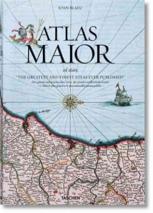
World class: The finest atlas ever publishedSuperlatives tend to fail in face of Joan Blaeu s Atlas Maior, one of the most extravagant feats in the history of mapmaking. The original Latin edition, completed in 1665, was the largest and most expensive book to be published during the 17th century. Its 594 maps across 11 volumes spanned Arctica, Asia, Europe, and America. Its scale and ambition occupies such an important place in Dutch history that it is included in the Canon of Dutch History, an official survey of 50 individuals, creations, or events that chart the historical development of the Netherlands.TASCHEN s meticulous reprint brings this luxurious Baroque wonder into the hands of modern readers. In an age of digitized cartography and global connectivity, it celebrates the steadfast beauty of quality print and restores the wonder of an exploratory age, in which Blaeu s native Amsterdam was a center of international trade and discovery.True to TASCHEN s optimum reproduction standards, the edition derives from the Austrian National Library s complete colored and gold-heightened copy of Atlas Maior, assuring the finest detail and quality. University of Amsterdam s Peter van der Krogt introduces the historical and cultural significance of the atlas while providing detailed descriptions for individual maps, revealing the full scale and ambition of Blaeu s masterwork. As much an artwork as a cartographical adventure, the book comes with a slipcase that converts neatly into a display bookstand.Text in English, French, and German"
Vypredané
62,65 € 65,95 €

National Geographic Atlas of the World Eleventh Edition


National Geographic's flagship Atlas of the World, now in its 11th edition, provides authoritative maps of every country, ocean, and region of the world, as well as thematic maps and accompanying graphics showing important population, environmental, and economic patterns. Organized by continent and reflecting today's political boundaries and identities, this authoritative atlas is an indispensable reference for schools and libraries, as well as the latest resource for home browsing and study. A thematically organized opening section uses current data to visualize urgent concerns, such as Earth's last wild places, changing freshwater availability, human migration and refugee movement, and human rights conditions globally. The back of the book contains basic facts and flags of every country, as well as a comprehensive index cross-referencing more than 150,000 place names.
Vypredané
213,75 € 225,00 €

Complete Atlas of the World


Complete Atlas of the World is the ultimate insight into our planet and the clearest, most concise overview of the world's geography. This incredible guide showcases locations from Boston to Bangkok and beyond with over 330 maps, including over 100 city plans, to truly bring these landscapes to life. Complete Atlas of the World is the definitive look at the world we live in. Detailed terrain models and colour schemes offer accessible mapping of unsurpassed quality. Complete Atlas of the World is now fully revised and updated to reflect recent geopolitical changes such as the new nation of South Sudan and the annexation of Crimea. Understand the fascinating world in which we live with this fantastic resource. Its previous edition ISBN 9781405394413.
Vypredané
42,75 € 45,00 €

Collins Junior World Atlas


A ideal reference atlas for young Primary School geographers aged 9-11 years published in association with the Geographical Association. * This atlas has topographical based mapping which helps the young geographer understand the processes which take place during the formation of the earth's landscapes. The atlas has been designed specifically as an introductory reference atlas for 7-11 year olds studying geography at Keystage 2. * The reference mapping is designed for maximum clarity and accessibility, and is supported with photographs and data files, with detailed map keys and scale information on each map. Specially selected topic maps give additional information linking to knowledge and understanding of distant places. * The atlas is organised into sections covering the UK, Europe, the World and Continents with larger scale maps of countries and regions popular for focus studies. A variety of carefully selected scales are used to allow for comparison of size and distance in different countries.
Vypredané
11,02 € 11,60 €

Collins Primary World Atlas


A curriculum-supportive Primary World Atlas for children aged 7-11 years (Key Stage 2). Designed for use in the classroom or at home, this revised edition includes informative politically coloured reference mapping of all major world regions. * This primary world atlas provides an introduction to mapping of the UK, Europe and all major regions of the world. It includes information on map reading skills, the meaning of scale and measuring distances. * The reference maps are informative, politically coloured, and easy to read with national capitals and major cities easily identifiable. The maps are supported with national flags and basic national statistics. * Continental maps are linked to the regional mapping and are supported by a selection of satellite, aerial and terrestrial photographs. Continental relief maps show layer colouring and major physical features are highlighted. * The index uses a simple grid reference system and a selection of web addresses is included to help with further study. * The Collins Primary World Atlas is also available on CD for use on interactive whiteboards, and a full range of interactive flip charts to support this atlas are available as downloadable files. These charts are easy to use and allow teachers and learners to further develop atlas skills. Downloads are available from www.collinseducation.com/atlases * Try the free interactive online Primary World Atlas quiz.
Vypredané
11,02 € 11,60 €

Collins School World Atlas


An introductory atlas for secondary schools, perfectly designed to support and motivate Key Stage 3 students in geographical and mapping skills. * Previously published as the award winning Collins Foundation World Atlas the Collins School Atlas has been revised and extended. It features 96 pages of clear, easy to read maps, satellite images, an atlas skills section and hundreds of statistics. * This introductory atlas for secondary school students aged 11-14 is designed to help students develop map, atlas and data handling skills. The content adheres closely to the requirements of the National Curriculum and incorporates results of classroom testing. * Its clear and accessible layout will motivate pupils of all abilities at Key Stage 3 and S1-S2. An easy to follow introductory 'map and atlas skills' section, useful for both teacher and pupil, is followed by clear, easy to read reference maps presented with locator maps, fact boxes and flags, descriptive text, detailed map keys and photos. For this new edition more detailed reference mapping of the British Isles is included. * Carefully selected focus country studies include mapping on contrasting regions and special topics. * The latest available country-by-country statistics are listed in a separate section and the index includes full latitude and longitude values. * The extended world section in this edition covers all the global issues required by the National Curriculum e.g. climate, population, biomes, earthquakes and volcanoes. * Colour coding of the titling and marginalia aids the identification of the sections within the atlas.
Vypredané
12,35 € 13,00 €

Compact Atlas of the World


This new edition of the Times Compact World Atlas, in a convenient, portable format, has been fully revised to bring all the maps and geographical information completely up-to-date to give an accurate picture of today's world. As with all the atlases in the Times range, it offers great authority, outstanding quality and attention to detail. Detailed reference maps in the distinctive and respected Times style provide balanced, systematic coverage of all parts of the world. Each continent is introduced by a political map showing individual countries, followed by regional maps showing towns and cities, roads, railways, international boundaries and topography. Key features of the atlas include: * The introductory section covers major world geographical themes - from earthquakes and volcanoes to population growth, communications and climate change - giving a global snapshot of our contemporary world. * Authoritative updated mapping of the whole world. * Geographical reference section with flags, statistics and facts for the world's states and territories. * Hundreds of place names updated. * Over 25,000 index entries. This is a complete world reference atlas in a convenient and easy-to use format, retaining the authority, style and detail of the larger atlases in the range.
Vypredané
16,53 € 17,40 €

Příruční atlas světa


Přehledný a praktický příruční atlas světa s aktuálními ověřenými informacemi o naší planetě nabízí politické a fyzické mapy světa ve vynikajícím rozlišení. Ilustrovaná textová část je věnovaná státům světa a kromě nejdůležitějších informací o jednotlivých zemích obsahuje i státní vlajky. Podrobný rejstřík pomáhá při rychlé orientaci v mapách.
Vypredané
15,58 € 16,40 €

Ak ste nadšeným cestovateľom a váš záujem siaha za hranice jednej knihy, táto kategória je určená pre vás. Nájdete tu široký výber atlasov, ktoré vás zavedú do rôznych častí sveta a poskytnú vám komplexný prehľad o geografii, kultúre, prírode a histórii rôznych regiónov.

Kategória Atlasy sveta, rodinné atlasy je plná detailných a prepracovaných atlasov, ktoré vám poskytujú informácie o rôznych geografických oblastiach. Nájdete tu atlasy, ktoré zahrňujú kontinenty, krajiny, regióny, mestá a ďalšie geografické jednotky. Sú to cenné nástroje pre štúdium, plánovanie ciest a objavovanie sveta.

Nájdete tu atlasy určené pre celú rodinu, ktoré obsahujú farebné ilustrácie, pútavé mapy, zaujímavé faktografické informácie, fotografie a popisy miestnych tradícií a kultúr.

Atlasy sveta vám umožnia objaviť rôzne regióny, zoznámiť sa s geografickými charakteristikami a národnými parkami, objaviť kultúrne a historické poklady a získať lepšiu predstavu o rozmanitosti sveta, v ktorom žijeme.

Rodinné atlasy sú vhodné pre všetkých členov rodiny, vrátane detí, a pomáhajú vytvárať puto s inými krajinami a kultúrami. Sú praktickým nástrojom pre vzdelávanie a zábavu a diskusiu o rôznych miestach a zemepisných údajoch.